Ohio Valley feels impact of Snowstorm Fern
-

- WRONG WAY — Jody Hurst walked her daughter’s dog, Cali, the wrong way down a one-way alley in downtown Weirton during Sunday afternoon’s snowfall. No citations were issued. — Michael D. McElwain
-
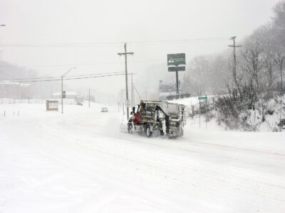
- CLEARING ROADS — A plow truck made its way up University Boulevard in Steubenville as snow continued to fall Sunday afternoon as part of a massive winter storm that blanketed the Northeastern United States. — Warren Scott
-
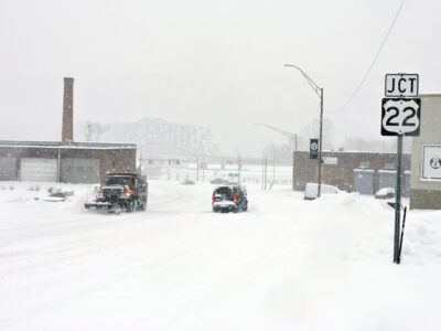
- SNOW COVERED ROADS — A plow truck proceeded up from the intersection of University Boulevard and Seventh Street, passing one of a small number of drivers who ventured onto local roads that were covered Sunday afternoon during a massive winter storm that blanketed the Northeastern United States. — Warren Scott
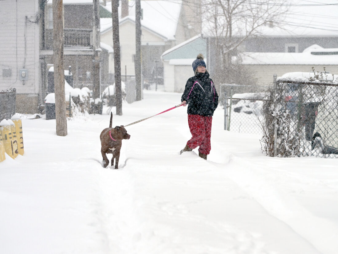
WRONG WAY — Jody Hurst walked her daughter’s dog, Cali, the wrong way down a one-way alley in downtown Weirton during Sunday afternoon’s snowfall. No citations were issued. -- Michael D. McElwain
Winter Storm Fern dumped up to a foot of snow onto the Ohio Valley Sunday, leaving area roads covered and treacherous and producing subzero temperatures that are expected to remain well after the precipitation has diminished.
The National Weather Service has predicted the snow will continue Monday, with 2 to 4 inches of additional accumulation possible.
Because freezing rain was a possibility for Sunday night, the agency has warned that may include a trace of ice.
In addition to the winter storm warning issued through noon Monday, the National Weather Service has issued an extreme cold watch up to noon on Tuesday.
The agency has predicted a high of 19 degrees on Monday afternoon with a low of 1 degree.

CLEARING ROADS — A plow truck made its way up University Boulevard in Steubenville as snow continued to fall Sunday afternoon as part of a massive winter storm that blanketed the Northeastern United States. -- Warren Scott
With projections of 10 to 15 mile per hour winds, gusting at up to 25 miles per hour, the temperature could feel like 16 degrees below 0 from the wind chill factor.
While little snow accumulation is expected late Monday into Tuesday, the cold is expected to persist.
The National Weather Service has predicted a high of 17 degrees, with thermometers settling at 0 on Tuesday. Winds of 16 to 25 miles per hour, gusting at up to 30 miles per hour, are projected, producing a wind chill factor of 10 degrees below 0.
The agency warns that wind chill can cause the outdoor temperature to feel as much as 25 degrees below 0, with a risk of frostbite to exposed skin in as little as 30 minutes.
For that reason, residents are encouraged to stay indoors and if they must go outside, to dress warmly, covering head, hands and face with hats, scarves and gloves.
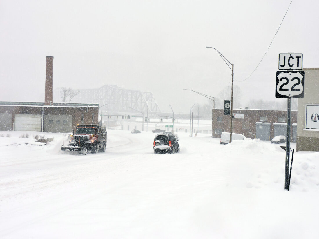
SNOW COVERED ROADS — A plow truck proceeded up from the intersection of University Boulevard and Seventh Street, passing one of a small number of drivers who ventured onto local roads that were covered Sunday afternoon during a massive winter storm that blanketed the Northeastern United States. -- Warren Scott
Area officials also have advised those with pets not to leave them outdoors. A number of local communities have ordinances through which a pet owner may be fined for doing so.
To prevent indoor plumbing from freezing, they should wrap pipes with cloths and allow faucets to drip.
Jefferson County Sheriff Fred Abdalla said on Sunday morning he had issued a Level 3 snow emergency advisory to reflect the hazardous roads found throughout the county.
The advisory means only emergency personnel are permitted on roads, with others facing fines or possible arrest.
“Obviously, if somebody’s been traveling and gets stranded, call us,” Abdalla said. “But what we don’t need is people calling us to ask, ‘How are the roads.’ The roads are bad.”
Abdalla said he has five deputies out on the road and eight others “on standby at their homes, prepared to respond to any call that might come in in their vicinity.”
“Obviously, if people don’t have power or they have any emergency, we’ll respond — we had a deputy go out and check pipes for a resident and turn off their main. We just don’t want people going out sight-seeing and we have to deal with that and then get a call where we have to respond to an emergency. ”
The sheriff noted his department transported a couple of nurses to work on Sunday.
Abdalla said he wasn’t aware of any serious auto accidents as of Sunday afternoon, though his department had to assist the driver of a vehicle that became stranded on the median on state Route 7 behind Steubenville High School,
As the snow continued to fall, the sheriff hoped area residents will use good judgment and avoid venturing out onto the roads.
Greg Moore, director of the Brooke County Emergency Management Agency, said close to a foot of snow had accumulated in some areas of the county, while at least another 5 to 6 inches was expected into Monday.
Moore said he was thankful few vehicles were on the roads Sunday and he wasn’t aware of any accidents.
He said residents should continue to remain at home until the snowfall has subsided on Monday.
Jeremy Ober, Hancock County director of emergency management, said most areas of the county on Sunday afternoon had received at least 10 inches of snow.
Ober said a number of vehicles had veered into ditches, but he wasn’t aware of any accidents with injuries.
He advised residents, “Roads are treacherous. Don’t travel unless it’s absolutely necessary.”
Officials at many school districts have announced schools will be closed.
And, officials with the Red Cross said Monday’s first day of the Media Blood Drive had been canceled. The second day was still scheduled to be held Tuesday between 11 a.m. and 5:30 p.m. at Wheeling Island Hotel, Cacino and Racetrack.
Steubenville Fire Chief Joe Ribar said that as of Sunday afternoon, they’d been lucky.
“We’ve had a few EMS calls but no fires,” he said. “The roads are causing a little delay with response times as expected (but) we have extra staff on duty at each station for at least the next 24 hours.”
Local officials weren’t aware on Sunday of any power outage caused by the storm.
But they have advised that should residents be without heat, a number of warming centers have been established and will be available provided residents can be safely transported to them.
In Brooke County, residents can call (304) 737-5002 to arrange for shelter at the Follansbee Community House, Wellsburg Fire Hall, Bethany Community Center or Beech Bottom Fire Department.
The Weirton Millsop Community Center has been identified as a potential warming center in Hancock County.
And, the Toronto Fire Department is prepared to use its city or Knoxville stations as warming stations. To arrange one, call (740) 537-5011.
Toronto Fire Chief Ryan Boyd reminded residents that a buildup of snow around furnace, dryer and water heater vents can cause carbon monoxide to enter a home.
Boyd said those with carbon monoxide detectors should check them and be aware that headaches, dizziness, nausea and confusion can be signs of carbon monoxide poisoning.
Local News

Edison board regroups for 2026

Kennedy Marina agreement to continue
Winter weather disrupts gas production
Widespread extreme cold is expected to restrict the production of natural gas in the U.S. in the coming days, with ...
Ohio Valley feels impact of Snowstorm Fern
Discussions continue on staffing of County Road station
WEIRTON — The dialogue between Weirton Council and the city’s firefighters continued Thursday, with an ...
Monday’s edition will be available online only
The winter storm that hit the Tri-State Area during the weekend prohibited us from being able to print or ...